Water bodies using earth observation
|
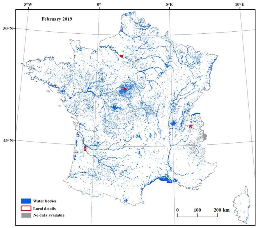
Monthly estimation of the surface water extent in metropolitan France High temporal monitoring is necessary to reflect the subtle variabilities in water bodies. We utilized Sentinel-2 to on a monthly scale at a 10-m spatial resolution. (1) An automatic rule-based superpixel (RBSP) approach is proposed. RBSP is automatically run in the Google Earth Engine (GEE) platform for large-scale dynamic mapping. (2) A product of Surface Water Dynamics in metropolitan France (SWDF) is generated with monthly, seasonal and annual surface water extents. |
|
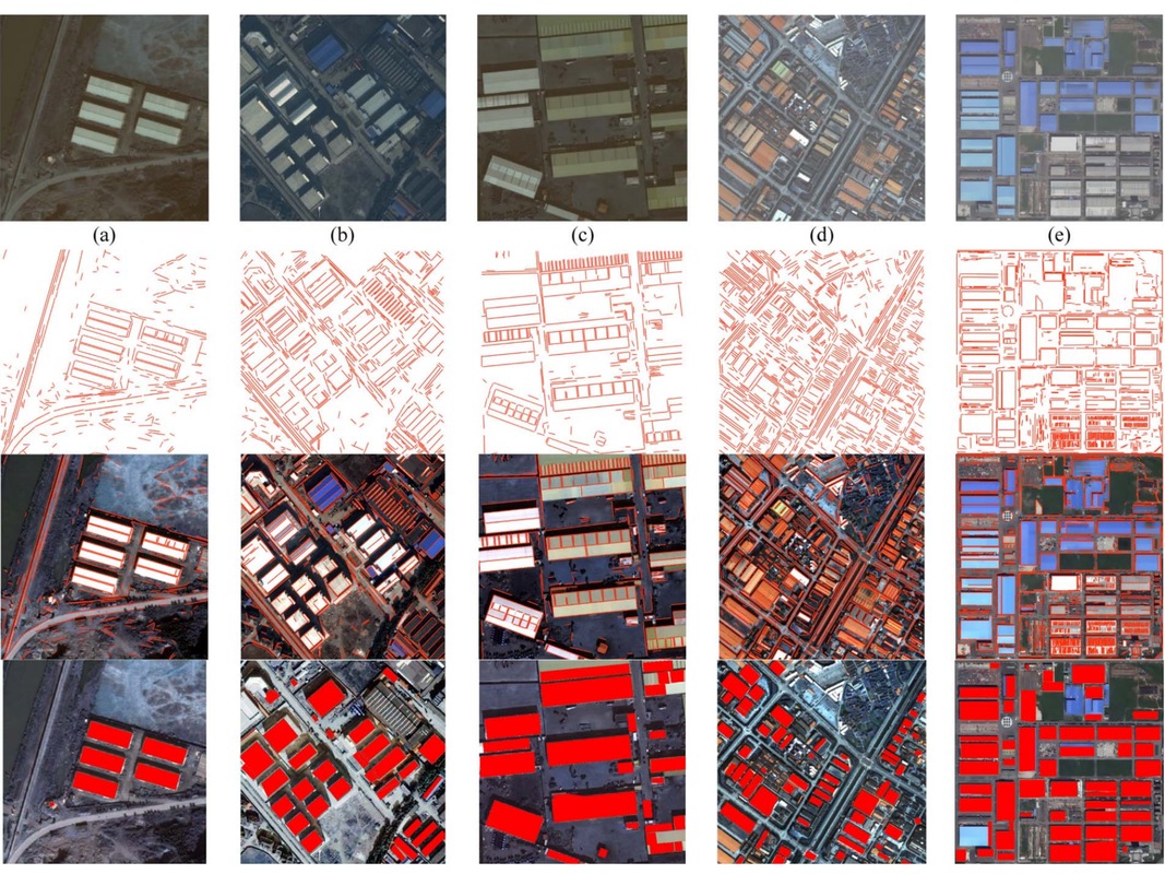
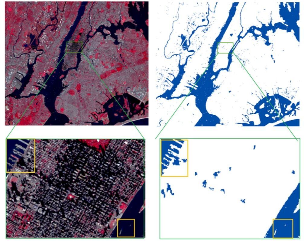
Urban surface water body detection Urban surface water mapping faces an extreme overestimation phenomenon because certain types of objects such as shadow, dark roads and some artificial features could be misclassified. Thus, we have done some works to improve the extraction accuracy from multispectral remote sensing images: (1) Compare different water indices and use object-oriented image analaysis (2) Propose a noise predication strategy to eliminate the misclassification by using CEM technique |